Fira to Oia Trail
Trip dates: March 16, 2017 - March 19, 2017
The scenic trail from Fira to Oia is a pretty well known hike and high on the to-dos when visiting Santorini. It goes along the caldera and offers pretty magnificent views along the way, and many people do this hike and end with the sunset in Oia.
Our cave house host told us that the trail consists of three parts: 1) Fira to Imerovigli - mostly walking uphill through the town with some views of the Aegean Sea along the way; 2) Imerovigli to the point where the trail intersects with the road - some uphill with views of the sea; and 3) intersection of trail with road to Oia - mostly flat with some ups and downs and the most scenic. He pretty suggested that we only needed to do part 3 and that was the most worthwhile.
We didn't have anything else planned for our second day on Santorini since we had pretty much seen everything at the top of our list (read about the rest of our time on Santorini here), so we decided that we'll start in Imerovigli and do most of the Fira to Oia trail. It ended up being a little under 6 miles (probably one of the longest hikes we've done) and the guy was totally wrong about the terrain of the trail. After completing the hike, we doubt that he's actually walked it!
Anyways, let me back up and start from the beginning. We decided to start at Imerovigli because we wanted to check out Skaros Rock and figured a long uphill climb through town from Fira to Imerovigli wasn't worth it. We caught a bus from Oia for 1.80 euro per person and got off at the stop in Imerovigli. It was super easy and convenient; you pay as you get on the bus, and you don't need to worry about exact change. You can actually take this bus to other destinations around the island too; it's just that the buses don't run that frequently if you want to hit multiple places in one day. You can find the bus timetable here.
When we got off at Imerovigli, there wasn't really much in terms of signage so we just headed west towards the water. There were several different possible paths and staircases down to the water, so just look for the ones that don't dead-end or lead to a private residence and you'll eventually get to the coast. Skaros Rock is a big rock (small plateau?) immediately west of Imerovigli that offers nice views of the caldera to both sides.


There's a series of steps that lead down and then up to Skaros Rock. We had read that while the path ends at the base, there's a relatively easy way to climb up to the top so we decided to check it out. We found the "relatively easy way" up based on the pictures we had seen and let me tell it, it is not easy! Maybe if you have rock climbing experience, or at the least are taller and have long limbs, but it was not easy at all for us. There are some pretty large rocks that you have to scale; the first part was pretty easy and not too bad at all. However, the last jaunt up to the top didn't have many foot/hand-holds that were close to each other.
Eric and I decided that only one of us should go up at a time so that the other can spot when you come down. Eric managed to hoist himself up and take some pictures around the top (too bad he got his fat finger in most of the pictures! hah). When he came back down though, it was kind of terrifying as he had to just let his body weight drop and trust that his foot would land on the foothold eventually. This is the part where if you're taller, it might not have been too bad at all. Anyways, after seeing Eric's pictures from up top and how difficult it was to climb down, I said no thank you and we clambered back down and returned to Imerovigli. While a cool experience to (try and) climb Skaros Rock, the rock is actually pretty big so the views from the top weren't really all that great. If anything, you get just as good (if not better) views from the base of the trail (the point at the bottom of Imerovigli before you start climbing up towards Skaros). Whew! What a start to the day, hope we didn't need to conserve that energy from climbing up and down for the rest of our hike!


We climbed up up up back to Imerovigli and were now warmed up and ready to hike back to Oia! Ok, we were actually already a little tired but onwards we go! We saw a sign every now and then pointing us to Oia, but while in town, it was hard to tell which exact path you should take. We just kept heading west and tried to stay as close to the coast as possible.
We eventually ended up on a paved path that had tons of new construction going on. We were pretty close to the coast though so we think this was where we were supposed to go. It was really beautiful, with the wildflowers all in bloom and the Aegean to our left. Nothing like the sounds of construction to complete the scene! But really, construction is the soundtrack of Santorini - it seems there's building or renovation going on everywhere throughout the island!

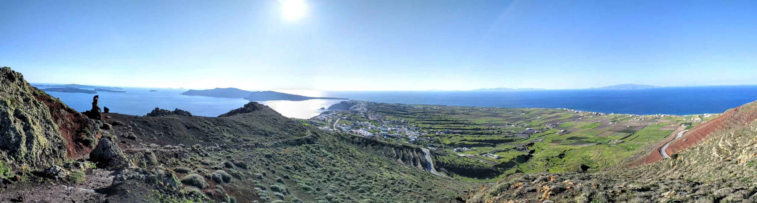
Eventually, we made it past the outskirts of Imerovigli and it was pretty clear that we were on the trail then, since there was only the one path. We continued along the path which was fairly easy, mostly flat or even slightly downhill. The terrain was constantly changing, from paved road to rock path to dirt path. We stopped several times to take in the views of the caldera as we went along.
We eventually hit a fork in the path, and the sign pointed us up and away from the main road. It was a steep uphill climb to St. Markos church, the first major milestone in our hike.


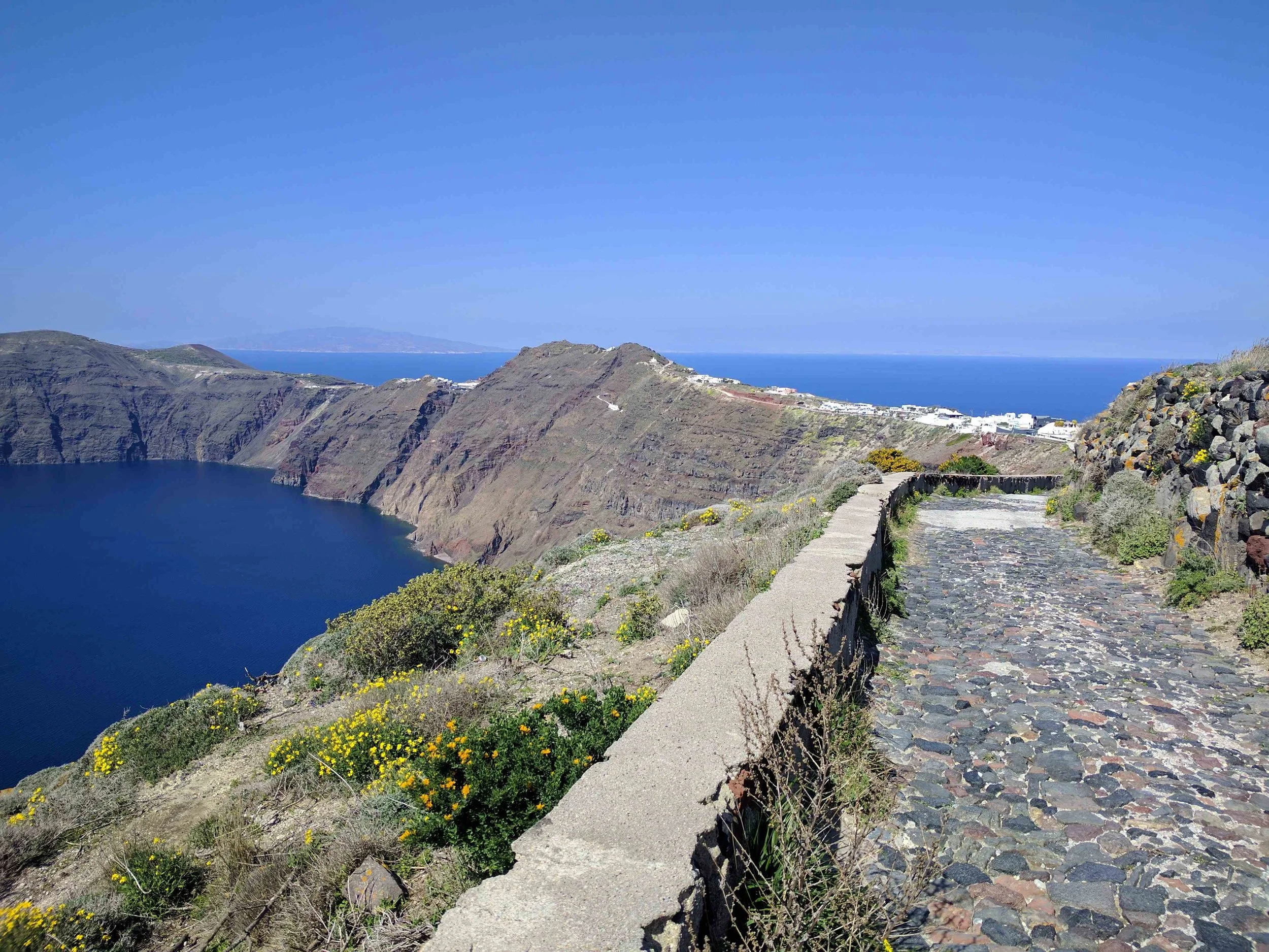


Leaving St Markos church, the path became much more of a volcanic rock/ash path. We headed up the path and followed it around a hill. The summit offered some nice views of the terraced fields of Santorini. From here, the path turned into a downward red, rocky ash path that was a little slippery at times, due to all the small loose rocks. The end of this path is the point where the trail intersects with the road. There is a bus stop on the opposite side of the road, the last stop along the trail before reaching Oia.
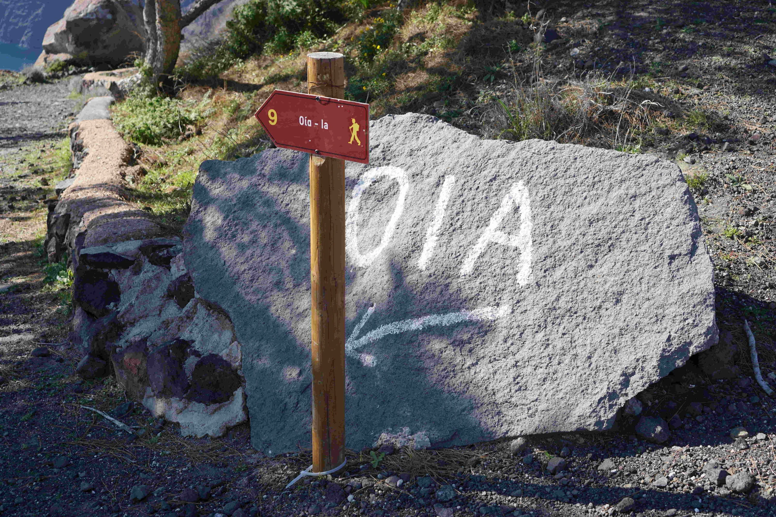


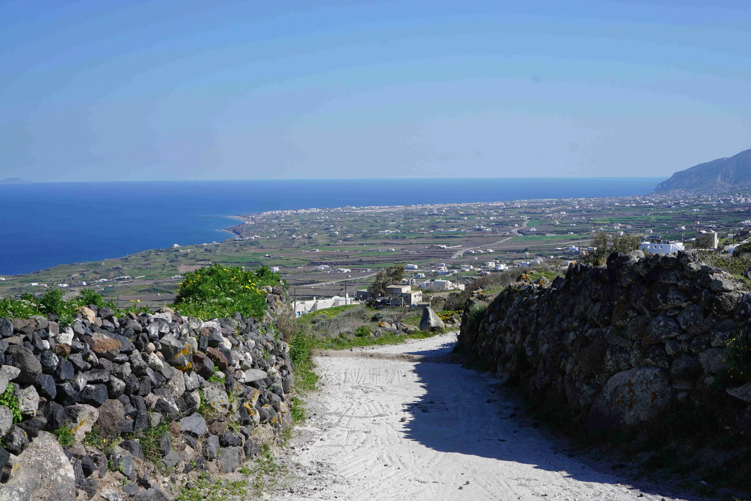
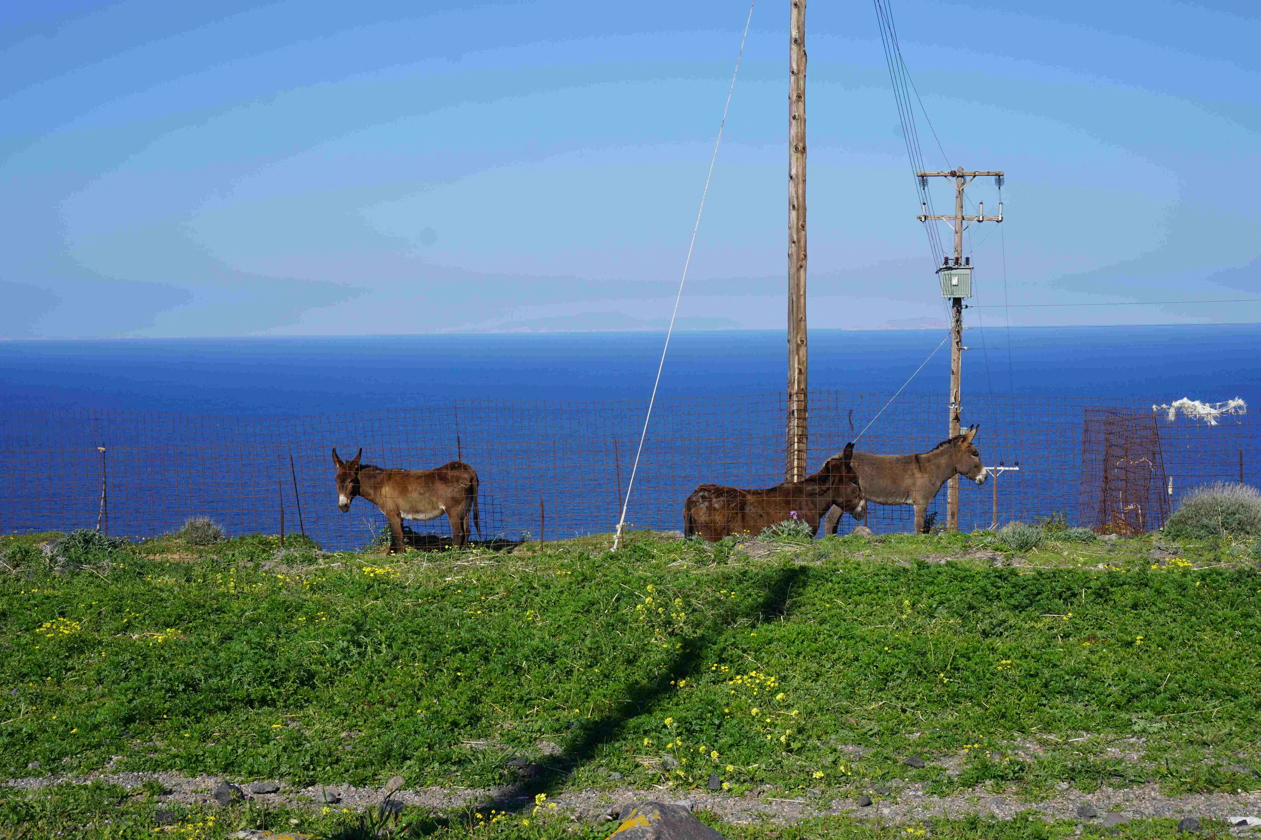
At this point, you have to walk along the road for a few minutes - not too bad as long as there isn't traffic on both sides. You'll then come across a dirt path again that cuts away from the road, with a small sign pointing to Oia. The path took us past the terraced fields and some vocal donkeys. From this point on, it was all an uphill trek on volcanic rock. There was no shade at all and the path you're walking on was also super hot. It was probably only in the 60s F when we were there so I can't imagine what it'd be like if you were to do this part of the hike in the heat of summer! Yeesh!
We followed the trail up and up, as we needed to crest the final hill. It seemed to take forever; Eric pretty much shut down as a result of this portion of the trail. The views of the caldera hadn't changed much and got old by this point, so it was a little hard to stay motivated. We eventually made it to the top, signified by the peach colored church.
Here, you're offered a panoramic view of Oia and the surrounding farm land and it was beautiful! We were now on the last leg of the hike, a downward path that eventually takes you to the road and into Oia.


Roughly 6miles and 4hours later, we had made it back to Oia! So was the Fira to Oia trail all that it's hyped up to be? I'm not sure. The views at the start of our hike by Imerovigli and the view of Oia at the final crest were very beautiful. But for the rest of the 5 or so miles in the middle, it kind of all looked the same. We also thought that by going to Skaros Rock, we kind of spoiled the views of the caldera for ourselves for the rest of the hike.
I'm glad that we hiked the trail, but I don't think we'd do it again. We would recommend it if you like hiking though, now that you know what to expect. Just don't go midday in the heat of summer, and bring plenty of water! You could also do just a portion of the trail or hike it in reverse, although you would miss out on seeing all of Oia open up before you when you crest that final hill then. If you've done the Fira to Oia hike, let us know what you thought! Did you think it was worth it and what was your favorite part?
[Technical Editor point: as of the last few posts, we've changed our image upload process to include re-sizing to a max of 1 MB per image (well, an ImageMagick mogrify to be specific). This was done in order to shrink our upload size to speed up our blog creation process, especially with less than stellar internet. It does have the side effect of lowering the quality of some images, especially the crazy gradients of blue in many of our sky pictures. If you are interested in seeing or using higher resolution pictures, just let us know! - E ]